
Property Lines That Settle Disputes Permanently
Boundary Surveys in the Quad Cities and surrounding areas for property disputes, new construction, and fence placement
Abbitt Survey & Development, PLLC recovers and re-establishes parcel corners for residential, commercial, and agricultural properties across East Moline and the Quad Cities region. Licensed surveyors retrace original survey monuments and corner markers to resolve questions about lot lines, easements, and encroachments before they escalate into legal conflicts or construction delays. The Mississippi River corridor, agricultural zones, and mixed development patterns throughout Rock Island County make precise boundary recovery essential when neighboring property owners disagree about shared lines or when irrigation improvements cross onto adjacent parcels.
The work involves locating original corner markers set decades ago, sometimes buried under soil or obscured by vegetation, and verifying those positions against recorded plats and legal descriptions. Field documentation captures the exact location of lot lines, any encroachments from structures or fences, and recorded easements that affect how you can develop or use portions of your land. Once the survey is complete, you receive a deliverable plat and updated legal description suitable for submission to title companies, attorneys, or county offices.
Schedule a property evaluation to identify specific boundary concerns before installing fencing or beginning construction.
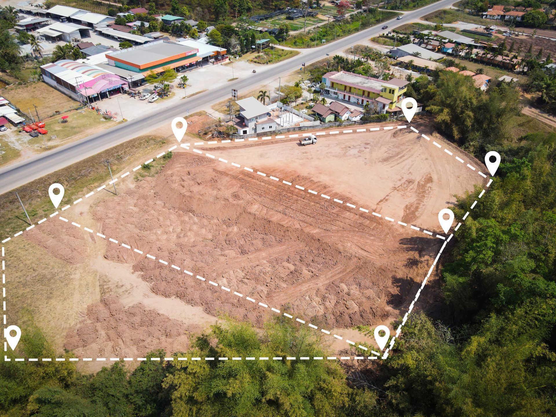
What Happens After Corner Markers Are Verified
Licensed land surveyors begin by reviewing recorded deeds, subdivision plats, and prior survey records to understand the original boundaries established for your parcel. Field crews then locate existing iron pins, concrete monuments, or other markers set by earlier surveyors, using precision GPS and total station equipment to measure distances and angles. If original markers are missing or disturbed, new monuments are set at the legal corner positions based on recorded dimensions and bearing calls.
After the fieldwork concludes, you see exactly where your property lines fall in relation to existing structures, driveways, and landscape features. Encroachments—such as a neighbor's shed sitting two feet over the line or a shared driveway that was never formally documented—appear on the final plat with measured distances. Easements for utilities, drainage, or access are plotted so you know which areas remain under your control and which portions allow rights to others.
The survey also supports subdivision of larger parcels, resolution of inheritance disputes where multiple heirs need defined shares, and compliance with lending requirements when refinancing rural or agricultural land. Homeowners use the documentation to install fences at the correct setback, farmers reference boundary lines when planning irrigation systems that approach neighboring fields, and developers rely on certified corners when staking out new construction on previously undeveloped lots.
What Property Owners Need to Know First
Boundary questions often surface during construction planning, fence installation, or when a neighbor challenges the location of a shared property line. The following answers address situations that prompt most requests for boundary recovery in Quad Cities and surrounding areas.
What does a boundary survey include beyond marking the corners?
Field crews document lot lines, locate and measure any encroachments such as structures or driveways crossing onto adjacent parcels, identify recorded easements for utilities or drainage, and produce a plat showing all findings with legal descriptions suitable for title companies or attorneys.
How does the Mississippi River corridor affect boundary work in East Moline?
River valley properties and parcels near floodplain zones often have irregular lot configurations, older monumentation that has shifted due to soil movement, and overlapping easements for levee maintenance or agricultural drainage, requiring careful analysis of recorded documents and field verification of physical markers.
When should I order a boundary survey before installing a fence?
Schedule the survey before any posts are set if you share a property line with a neighbor who has expressed concerns about the location, if no existing markers are visible at the corners, or if your lot is part of an older subdivision where original iron pins may have been removed or buried during landscaping.
What happens if the survey reveals an encroachment onto my land?
The plat documents the encroachment with measured distances and identifies the structure or improvement involved, giving you certified evidence to resolve the issue through negotiation, formal easement agreement, or legal action if the neighboring owner refuses to address the problem.
How long does a boundary survey remain valid for construction or legal purposes?
The physical corner markers and recorded plat remain valid indefinitely unless new development or subdivision activity changes the parcel boundaries, but lenders and title companies may request updated surveys if the most recent documentation is more than ten years old or if visible improvements have been added since the last survey.
Abbitt Survey & Development, PLLC has served homeowners, developers, and agricultural landowners throughout the Quad Cities with boundary recovery and corner certification for property disputes, construction projects, and regulatory compliance. Request a detailed estimate based on your parcel size and the complexity of recorded easements affecting your land.